21 October 2013

Waterfront Development: Brooklyn Bridge Park


Similar to the Harbor Point site visit, I visited Battery Park City and Brooklyn Bridge Park on September 27th to study waterfront development. Regina Myer of the Brooklyn Bridge Park Corporation presented some information on Brooklyn Bridge Park that I share below.

History


The original piers were built in the 50s and 60s for bulk cargo. It wasn't until the 80s that they realized the piers were no longer useful and most of them were closed.

Park Details and Design


The park includes a 1.3 mile long esplanade that one can walk along the New York harbor to get views of Staten Island and the Statue of Liberty, the lower Manhattan skyline, the Brooklyn Bridge, The Manhattan Bridge, and much more. There are 6 piers, Fulton Ferry Landing, Empire Fulton Ferry Park, and Main Street Park of DUMBO with free Wi-Fi and charging stations.

Pier 1 is the only one created with landfill. Landscape architecture is different on Pier 1 from other piers because of this. Utilizing salvaged materials from excavation for the Long Island Rail Road, they were able to create a hill 20 ft above the original pier height for better views of the lower Manhattan skyline. There large lawns where they can have gallery and art installations and guests can play or have picnics.


Youngstown Ohio developer donated a historic carousel to the DUMBO pier, Jane’s Carousel.

Pier 5 has three soccer fields utilized by St. Francis, youth and adult weekend leagues, and local schools.

Ted Zoli, a leading highway bridge designer, designed the pedestrian bridge at Pier 1.

The park has had great success. There have been over 1 million visitors to Brooklyn Bridge Park this year to a space that was pretty much off limits about 5 years ago.

Pier 6 has sand volleyball and non-motorized boating (e.g. Canoeing and kayaking).
Etsy, a website catering to the sell of handmade, artsy goods, is headquartered in DUMBO right off the park with an art lab open to the public for art making.

Financing


Parks on the waterfront are more expensive to maintain. Park maintenance is not funded by city, state or federal funds. They raise money through concessions and development sites. The condos near the piers and park pay ground rent and taxes directly to the corporation. The Johns street section was privately owned and has been acquired for park space and a 15 story apartment building.

Empire Stores
Public Art in Brooklyn Bridge Park
Jane's Carousel

Historic Preservation, Resilience, and Sustainability


The Empire Stores building will be preserved and restored.

Brooklyn Bridge Park is inherently resilient. During Super Storm Sandy, loss of plant life was much less than in other areas because they used salt resistant plants, rip rap, and storm water management. Unfortunately, the shoreline still lost electricity for 4 months.

As previously mentioned, fill comes from subway excavation. The park also reused stones from bridge projects and wood for the benches and other décor was reclaimed from original buildings on the piers. They also reused the steel framing from old buildings seen on Pier 6.

Public Art in Hudson River Park
Battery Park City Site Plan
Park View

Compare and Contrast


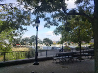
Hudson River Park in Battery Park City has the distinctive old school, regal park design. It utilizes traditional materials like the octagonal pavers. Brooklyn Bridge Park on the other hand uses basic, raw materials like wood and concrete. Hudson River Park feels like Central Park in that the trees act as a barrier to the outside world and you are immersed in the park once you enter. Even with the natural barrier of the expressway, Brooklyn Bridge Park feels more incorporated into its surroundings. It is open and views from every corner of every pier and the esplanade are unobstructed. While you can get lost in nature for a while you never forget that people live just a block away. Both parks offer calmness in the hustle of the City, Brooklyn Bridge Park seems more inviting for the active with volleyball courts and soccer fields. I love the use of public art in both places, but I’m drawn more to Brooklyn Bridge Park. I can see myself spending evening and weekends there with friends. Walking/Jogging on Saturday mornings and looking forward to events held in the park.

What I like about Brooklyn Bridge Park and what I think they do well is programming and public events. Photoville and the DUMBO Arts Festival were welcomed parts of the parks events while we visited. I think Baltimore does a good job of programming events, as well, through the Waterfront Partnership for the Inner Harbor, Harbor East, and Fells Point. Although small, West Shore Park at the Inner Harbor is similar to Brooklyn Bridge Park in that it uses basic materials and it’s very open with unobstructed views of the CBD and the rest of the harbor.  
The “Public”


Even though most of the parks and the esplanade in Battery Park City were there before the buildings, they seem more like an amenity for the adjacent residential buildings. It doesn't feel public. I observed nannies pushing expensive strollers and businessman in suits on lunch. It doesn't seem as inviting for the average New Yorker; they may feel out of place. A certain kind of person can afford to live in the condos and apartments surrounding the parks and I’m not sure if I lived in New York I would go to this park in my spare time.


Waterfront Development: Harbor Point

Source: baltometro.org

On Tuesday, September 10th, I visited the Harbor Point Site just south of Harbor East on Baltimore's harbor. Mike Ricketts, who has 30 years experience in development, educated me on the specifics of the site's development. The following are my notes and reflections from that visit.

I. Project Details


History of Harbor East


It used to be a 70-acre lumber yard with a chromium processing plant that sat on the now Harbor Point site. Chromium preserves wood.

When the plant and lumber yards closed, Baltimore City didn’t want the land broken up into smaller parcels. They wanted an extension of the Inner Harbor for that area. The area vacant at that point was 16 acres. Mayor Schaefer asked a friend/developer to buy the land and hold it to be bought back by the city later. Mayor Schaefer became the governor and needless to say, never bought the land back.

The location and lot size was unique in that it afforded large commercial floor plans, usually seen in the suburbs, with space for parking and even residential opportunities.

The Lancaster building was the first to be built on the Harbor East 16-acre site. It was pre-leased and had 100% occupancy upon opening. It also provided ground floor retail and apartments.

Later the developers proposed a grocery store, Whole Foods, on the ground floor of one the office buildings. The office didn't like the idea of having a grocery retailer in their building, but they were all but won over when Whole Foods was successful with employees and residents alike. Whole Foods benefited greatly for the first 3 years because they were not required to pay rent or operating expenses.

The original 16 acres took about 15 years to develop.

With 1.1 million square feet, the Vue Harbor East building is the largest mixed use project in Baltimore. The Legg Mason building, once completed, will be 1.9 million square feet.

Harbor Point


The 27 acres known as Harbor Point had chromium contamination. Chromium and its byproducts are known to be as harmful as asbestos. The area has a cap that stops the chromium from further contaminating the land and will not be disturbed by the development. The developers will not excavate the land; everything will be built up except the foundation.

The entire site seeks to be an eco-district and environmentally responsible. All buildings in the development area will be LEED Gold or better. The developers will be creating green space and capturing rain water for irrigation. Ten of the 27 acres is dedicated to public open space maintained by the Baltimore Waterfront Partnership. The Exelon building will be the second building on site, Morgan Stanley is the first, and is LEED Gold.

II. Public Access
Apart from the Morgan Stanley building there is nothing currently on the site; it’s basically a parking lot of gravel and rock. For this reason there’s no public access to the water or use of the space. Any addition of public, green space would be an improvement, but I can’t help thinking about how “public” the spaces will be. When we discussed it with Mike he explained that there were already uses that would be prohibited.

The unique thing about Baltimore’s harbor is that there is very little obstruction between the water and people; you can literally walk up and touch it. At Harbor Point this connection will be continued. The development will include a large public park and smaller green spaces between buildings. Central Street will be extended via bridge to the new development, but will not hinder access to the water.

III. Pros and Cons


One of the best aspects of this development is the creation of green, open, public space. This area is a brownfield that hasn’t had as much as a tree in recent history, so adding green space is not only a social opportunity and residential amenity, but also an environmental asset. On the same note, the development seeks to be an eco-district with LEED certified buildings, storm water capture and irrigation systems.

The most unsettling parts of this project are that the site, although capped, is chromium contaminated and that the project is being funded through tax increment financing. Both these things could potentially be detrimental to the site and city respectively. If for some reason the cap doesn’t hold or can support the type of proposed development, the water and ground all around would be contaminated. Moreover, with tax increment financing, if for whatever reason the development doesn’t generate the value projected, the city would have to pay the investors and the city residents would lose out on those tax dollars.

IV. Visual Comparisons


The biggest difference between Harbor East and the Inner Harbor is density. Harbor East has large buildings separated by small streets and although the streets are tree lined there are no green spaces in the development. While there is a waterfront promenade, the buildings seem to block people from the water. Harbor East was made for living. There are hotels and restaurants, but also apartments and condominiums. The development is mixed use.

The Inner Harbor on the other hand, is much more open with direct access to the water. There’s space for large groups to move together on the promenade. It is definitely made for tourists filled with niche and novelty shops, restaurants, and single use buildings. There are only hotels, no residences and the office space is a few blocks away in the central business district. While both areas are walkable, the Inner Harbor feels safer to walk around. You can walk from Pier Six to Rash Field and beyond without crossing a street or coming into contact with vehicular traffic.

Other than the physical design of the buildings in the inner Harbor, I wouldn't change much of anything. Everything services its purpose and people seem to like it. For Harbor East I would incorporate a park and more greenery.